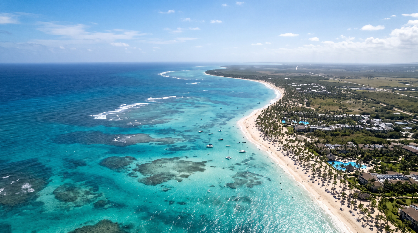
Punta Cana is located on the easternmost tip of the Dominican Republic, which sits on the island of Hispaniola in the Caribbean region. It is situated in the La Altagracia province, facing both the Atlantic Ocean to the north and the Caribbean Sea to the south.
| Quick Facts: Punta Cana Geography & Logistics | Official Details |
| Exact Coordinates | 18.5820° N, 68.4055° W |
| Province / Region | La Altagracia |
| Country | Dominican Republic |
| Continent | North America (Caribbean Subregion) |
| Bordering Oceans | Atlantic Ocean (North), Caribbean Sea (South) |
| Main Airport Code | PUJ (Punta Cana International Airport) |
| Primary Language | Spanish (English is universally spoken in tourist zones) |
| Local Currency | Dominican Peso (DOP) |
Where Exactly Is Punta Cana Located? (Geography & Map)
Punta Cana physically occupies the extreme eastern coastline of the Dominican Republic. Because of its unique geographic position jutting out into the water, it acts as the exact dividing line where two major oceanic bodies collide.
The Exact Location on the Map
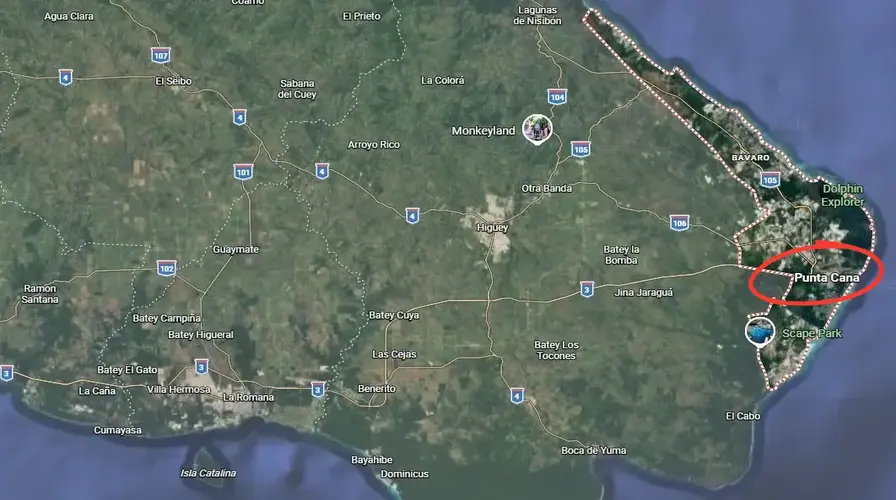
Look at a map of the Caribbean. You’ll spot the Greater Antilles archipelago right in the middle. The Dominican Republic sits squarely in the center of this island chain, and Punta Cana anchors its absolute eastern edge. It falls under the jurisdiction of the La Altagracia province. Higüey serves as the regional capital—a busy, working-class city located about 45 minutes inland from the beach resorts.
If you map the distance to Santo Domingo, the nation’s capital, you’re looking at a 195-kilometer (120-mile) drive west. Decades ago, that trip took all day. Today? The Autopista del Coral toll highway cuts that journey down to a smooth two-and-a-half hours. You literally drive straight through endless fields of sugarcane before hitting the coastal scrublands that define the eastern cape.
The Meeting Point of the Atlantic Ocean and Caribbean Sea
Your exact spot on the coastline dictates the kind of water you get. The northern stretches of the tourist corridor—specifically the Macao and Uvero Alto beaches—face the open Atlantic Ocean. Expect stronger currents here. You’ll see actual waves crashing on the shore, deeper blue offshore waters, and plenty of local surfers taking advantage of the swells.
Head south toward Bavaro and down into Cap Cana, and the geography shifts. The coastline hooks inward, facing the Caribbean Sea. This natural curve completely blocks the heavy Atlantic swells. The result is what you see in the brochures: flat, shallow, turquoise water that looks like a swimming pool. If you pull up local weather forecasts before your flight, you’ll consistently notice that the Caribbean-facing bays report significantly calmer wind and surface conditions year-round.
Climate, Weather, and the Best Time to Visit
Sitting just 18 degrees north of the equator guarantees you are stepping into a classic tropical climate. Temperatures barely fluctuate. You can expect daily highs to hover right between 82°F and 88°F (28°C to 31°C) in January or July.
Our peak travel season perfectly aligns with the northern hemisphere’s winter. From mid-December through April, the humidity plummets. Rainfall practically disappears. Summer shifts the dynamic. You get warmer ocean water, but the humidity spikes and short, intense afternoon rain showers become common. Reviewing historical Punta Cana weather trends helps you schedule outdoor excursions for the morning hours when the skies are typically dead clear.
What Country is Punta Cana In? (Understanding Hispaniola)
Punta Cana is located entirely inside the Dominican Republic. It’s not a separate island. It’s not an independent territory. The Dominican Republic actually shares a massive landmass with a neighboring country, which creates a highly unique geopolitical setup.
Dominican Republic vs. Haiti: The Island of Hispaniola
The physical island is named Hispaniola. It ranks as the second-largest island in the entire Caribbean, sitting just behind Cuba in total square footage. The Dominican Republic controls the eastern two-thirds of Hispaniola. This side features the highest mountain peak in the Caribbean (Pico Duarte), massive agricultural valleys, and hundreds of miles of white-sand beaches.
Haiti controls the western third of the island. Because Hispaniola is so vast, the eastern tourist hubs are hundreds of miles away from the Haitian border. If you rented a car at your resort and tried to drive to the western border, you would be on the road for seven to eight hours crossing through heavy mountain terrain and multiple military checkpoints. Data from the Dominican Republic Ministry of Tourism confirms that the eastern coastal vacation zones operate completely isolated from the western border regions.
Common Myth: Is Punta Cana in Mexico?
We see this search intent constantly. First-time travelers often assume this destination sits somewhere in Mexico. It doesn’t. Punta Cana is absolutely not in Mexico.
This confusion usually happens because both countries speak Spanish and both feature massive all-inclusive resorts (think Cancun or Tulum). Geographically, they sit nearly 1,200 miles apart. Mexico attaches directly to the North American continent. The Dominican Republic is an island nation completely surrounded by the ocean. Flight paths from the US East Coast are totally different. You fly straight south over the Bahamas and Turks and Caicos to get here, never crossing the Gulf of Mexico.
Punta Cana vs. Bavaro vs. Cap Cana: Understanding the Coastal Areas
Travelers use “Punta Cana” as a catch-all name for a 30-mile stretch of beach. That’s a mistake. The region is actually sliced into distinct neighborhoods. Each zone offers a completely different aesthetic, price tag, and geographic advantage.
Punta Cana (The Original Village & Airport Area)
The name technically belongs exclusively to a privately owned geographic sector located just south of the airport. Developed back in the 1970s by Frank Rainieri, this original village houses the Puntacana Resort & Club, high-end residential neighborhoods, and the airport itself. Visitors heading over to Playa Blanca Punta Cana will find themselves standing in this exact southern sector. The ocean here is incredibly shallow, heavily protected by offshore reef barriers, and strictly Caribbean.
Bavaro (The Most Popular Tourist Hub & Best Beaches)
Drive 15 minutes north from the airport terminals and you hit Bavaro. This is the absolute economic engine of the region. Decades ago, developers built Bavaro as a housing zone for resort construction workers. It exploded. Today, it serves as the primary tourist hub. If you booked an all-inclusive mega-resort, you are almost certainly staying in Bavaro.
The coastline here features the wide, powdery white sands you expect. Walking the Bavaro Beach strip reveals endless rows of coconut palms, beachfront bars, and constant foot traffic. Locking down things to do in Bavaro takes zero effort because every major tour operator, nightclub, and shopping plaza operates right off this central strip.
Cap Cana (Exclusive Luxury & Marina)
Sitting at the extreme southern tip of the tourist corridor is Cap Cana. This is an ultra-exclusive, gated, master-planned community built for high-net-worth travelers. You won’t find loud party boats here. Instead, you get PGA-level golf courses, secluded luxury hotels, and the largest inland marina in the Caribbean. The geography shifts here too. You’ll see dramatic limestone bluffs and dense tropical forests replacing the flat palm groves of Bavaro. Finding things to do in Cap Cana usually involves booking upscale dining reservations, chartering fishing boats, or exploring the massive Scape Park cenote systems.
Uvero Alto & Macao (Quiet, Secluded & Surfing Friendly)
Push 40 minutes north of the airport and the vibe changes completely. Uvero Alto and Macao face the rougher Atlantic. The sand shifts to a rich, golden amber color. Macao Beach actually remains one of the only public beaches in the region entirely untouched by hotel development. Local surfers dominate the water here. Hotels up in Uvero Alto sit much farther apart. Travelers book small resorts in Punta Cana within this northern zone to escape the loud, bustling Bavaro crowds and enjoy total isolation.
Punta Cana Geography & The Sargassum (Seaweed) Factor
We need to talk about the seaweed. Sargassum is a naturally occurring brown macroalgae. It floats in massive, island-like patches across the open Atlantic Ocean. Shifting global ocean currents and rising water temperatures push this seaweed directly onto the eastern shores of the Dominican Republic during specific months.
Because the main Bavaro tourist coastline directly faces the prevailing eastern trade winds, these resorts frequently battle heavy seaweed accumulation from May through August. The hotels don’t ignore it. They invest millions in offshore barrier nets and run heavy tractors down the sand every single morning at dawn to keep the beaches clean.
But local geography offers a massive loophole. Beaches that face south or southwest naturally block those incoming Atlantic currents. If you travel during peak sargassum season, simply choose a southern-facing beach (like Bayahibe) or book offshore boat excursions. Getting off the sand and onto a boat guarantees you still get the crystal-clear water you paid for.
Where Do the Best Boat Trips & Excursions Depart From?
Your exact hotel location determines where your ocean tours will physically launch. Because shallow coral reefs block large boats from pulling up to certain beaches, marine operators rely on specific geographic departure points.
Marina Cap Cana (Luxury Yachts & Deep Sea Fishing)
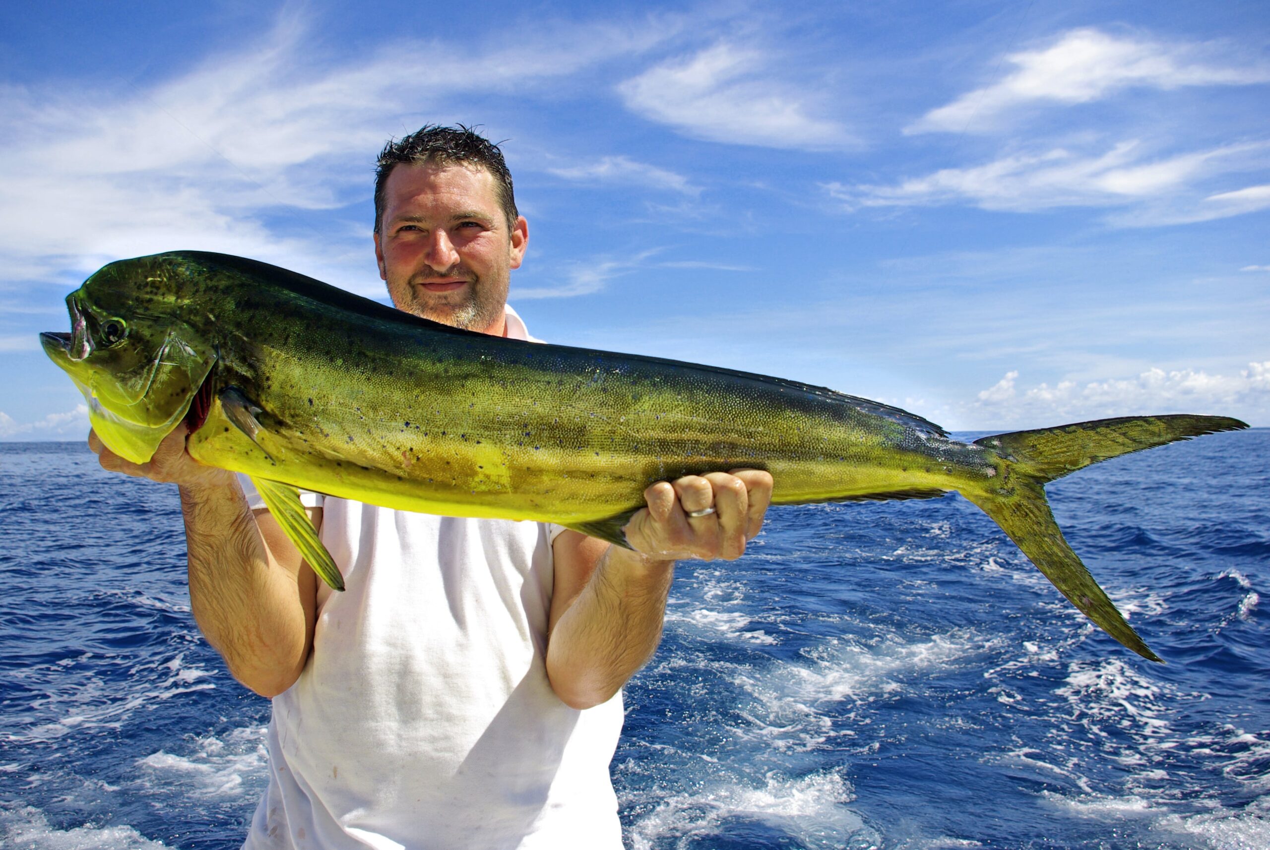
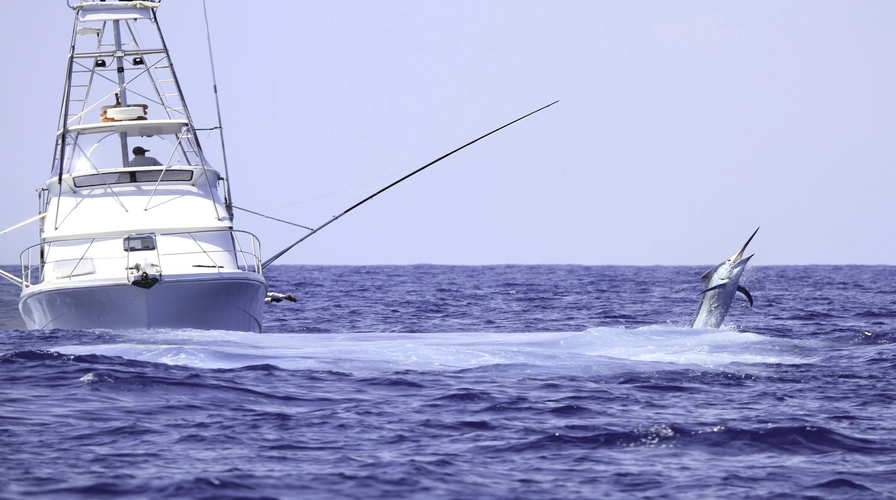
The Cap Cana marina features the deepest drafted waters in the entire area, allowing massive vessels to dock safely. If you book a luxury yacht rental Punta Cana, your private driver will transport you directly through the security gates of this community to board your vessel. This marina’s extreme southern location also gives captains immediate access to the Mona Passage. This deep-water channel between the DR and Puerto Rico is globally recognized as one of the best sport-fishing grounds for marlin, wahoo, and mahi-mahi.
Bibijagua Beach & Los Corales (Catamarans & Party Boats)
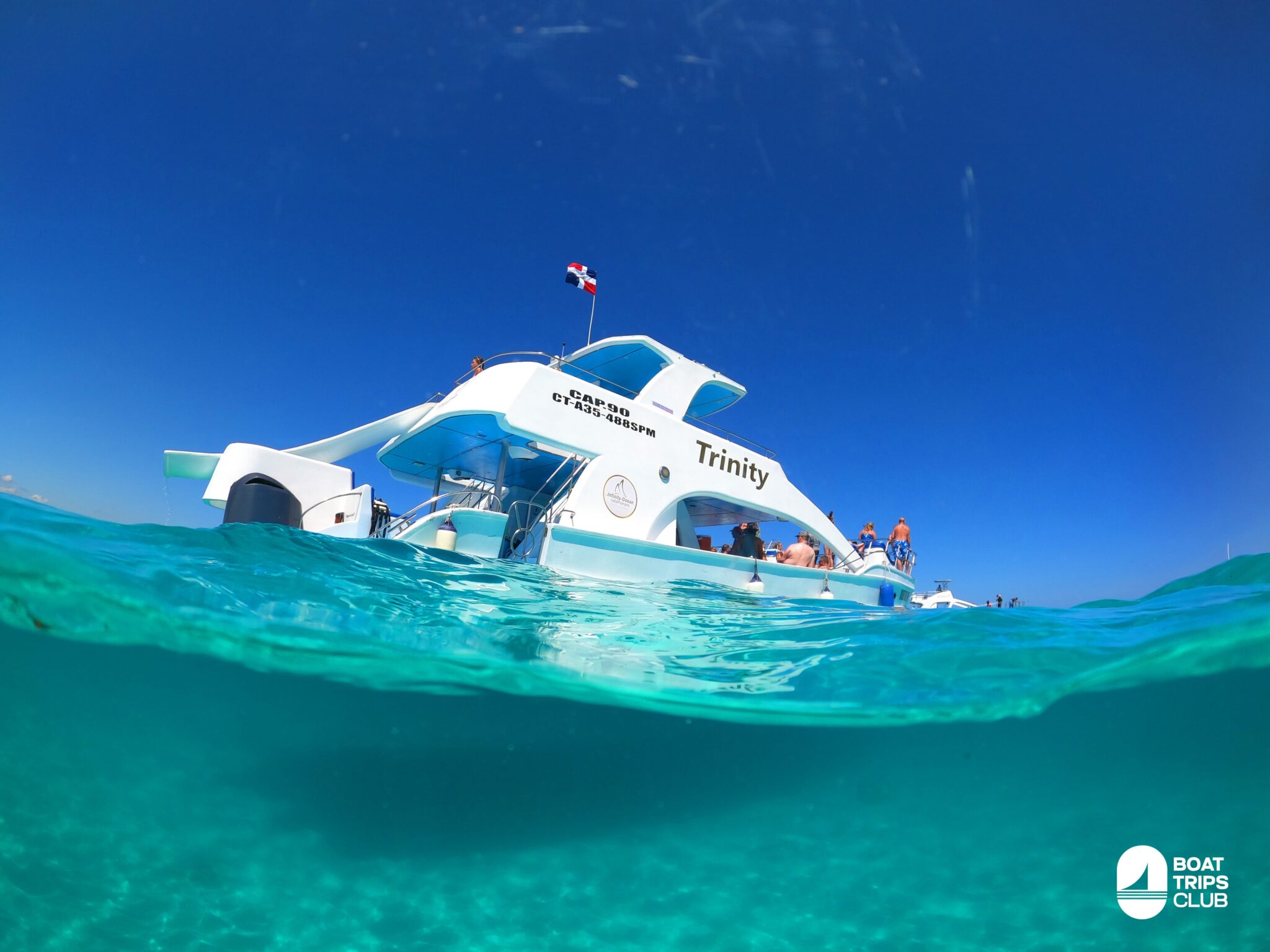
The vast majority of lively group tours launch straight off the sand in Bavaro. Specific public access points like Bibijagua Beach operate as loading zones. You walk down to the beach, wade into knee-deep water, and hop on a small shuttle boat that ferries you out to a larger vessel anchored behind the reef.
Reserving a catamaran Punta Cana Bavaro guarantees you’ll board right in the thick of the action. This geographic zone is prime real estate for snorkeling the coastal reefs, wading waist-deep in the natural swimming pools, or enjoying a sunset cruise Punta Cana as the sky lights up over the resort skyline.

Bayahibe (Departure for Saona Island)
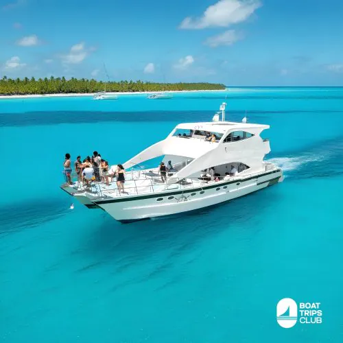
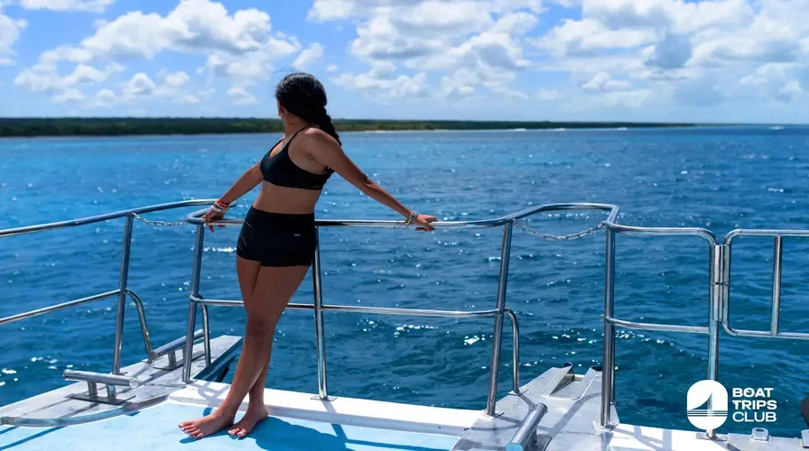
Bayahibe is a sleepy fishing village located about 45 to 60 minutes southwest of the main resort zones. While it requires a drive, Bayahibe serves as the strictly enforced departure point for accessing the government-protected Cotubanamá National Park.
Because Saona Island sits deep in the calm Caribbean Sea, boats cannot legally or safely navigate the rough eastern cape from Bavaro to get there. Securing private boat charters that launch from the Bayahibe docks gives you access to the most pristine, untouched waters in the entire country. Specifically, any private Saona Island catamaran itinerary must start with ground transport down to this southern port.
How to Get to Punta Cana: Airports & Transportation
Traveling to this coast is incredibly efficient. The Dominican government centralized the infrastructure here explicitly to handle massive volumes of international tourism without bottlenecks.
Punta Cana International Airport (PUJ) – The Main Gateway
The Punta Cana International Airport handles over 60% of all flights entering the country. It’s an architectural standout. Characterized by massive, open-air thatched roofs made from local palm fronds, the facility blends modern airport efficiency with a heavy tropical aesthetic. Navigating the Punta Cana airport layout is simple. You have two main terminals (A and B). They even offer dedicated VIP arrival services that literally fast-track you past the customs lines and straight to a private lounge featuring an outdoor swimming pool overlooking the tarmac.
Direct Flights from the US, Canada, and Europe
Geographic proximity makes getting here fast. Direct flights out of Miami touch down in just over two hours. If you fly from New York or Toronto, you’ll land in roughly four hours. European travelers flying out of Madrid, Paris, or London face longer transatlantic routes—usually clocking in between eight and nine hours. However, direct routes run daily through major legacy carriers, so you rarely have to deal with annoying layovers.
Getting from PUJ Airport to Your Resort
Once you clear customs and grab your bags, you need reliable ground transport. The airport sits at the very southern end of the tourist corridor. Driving up to Cap Cana takes just 15 minutes. Bavaro takes 25 minutes. Uvero Alto requires a solid 45-minute drive north.
Do not rely on the chaotic taxi lines outside the terminal. Securing pre-booked Punta Cana airport transfers guarantees an air-conditioned, private SUV or van is waiting for you with a name sign the second you walk outside. Before you land, read up on local Punta Cana currency rules so you know exactly whether to tip your driver in USD or Dominican Pesos.
Distances from Punta Cana to Major DR Attractions & Cities
If you plan to rent a car or book private sightseeing excursions, you have to understand the geographic scale of the Dominican Republic. It’s a big country. Travel times vary wildly based on highway access.
- La Romana & Bayahibe: 45 – 60 minutes via the Autopista del Coral. This is an easy, straight-shot drive on a modern toll road. It’s ideal for golf trips, marina dinners, or boarding boats. Checking out things to do in La Romana reveals incredible spots like the Altos de Chavon amphitheater.
- Santo Domingo (Capital City): 2.5 hours via Highway 3. Another straightforward drive on well-maintained toll roads. Exploring things to do in Santo Domingo drops you right into the Colonial Zone—the very first European settlement in the Americas.
- Saona Island: 1-hour drive to Bayahibe, immediately followed by a 45-minute speedboat ride across the Caribbean Sea.
- Samaná Peninsula: 4.5 hours driving. You can also book a short 45-minute domestic charter flight. The region is globally famous for seasonal humpback whale watching.
- Puerto Plata: 6 hours driving. This city sits on the far northern coast. Getting there requires a heavy, cross-country journey through the central mountain ranges.
Is Punta Cana Safe? Location-Based Safety Tips
The eastern tourist corridor stands statistically as one of the safest vacation destinations in the entire Caribbean. The local economy relies 100% on tourism dollars. Because of that, security protocols are strict, heavily funded, and highly visible everywhere you go.
Resort Safety vs. Public Beaches
Every major hotel operates as a gated compound. Private security monitors vehicle and pedestrian access 24/7. When travelers ask is Punta Cana safe to visit, the reality on the ground inside the resorts is total security. You wear a wristband to prove you belong there.
The beaches immediately in front of the hotels are heavily patrolled by POLITUR—the specialized Dominican tourist police. They ride up and down the sand on ATVs. While petty theft can happen (like leaving an expensive iPhone unattended on a towel while you swim for an hour), violent crime targeting tourists in these specific zones is exceptionally rare.
Safe Transportation Around the Area
Transit risks drop to zero when you use common sense. Rely on scheduled hotel shuttles, licensed tour operators, or highly rated private transfer companies. Do not hail unmarked street taxis late at night if you wander outside the resort zones. If you want to leave the property for dinner, have your hotel concierge call a verified, dispatched taxi. It guarantees a safe, tracked ride to your destination and back.
Top Resorts in Punta Cana by Location
Your personal travel style should dictate exactly which geographic zone you book. Each micro-region caters to a completely different demographic.
Best Family Resorts in Bavaro
Bavaro brings the noise and the action. The ocean is calm, the entertainment staff runs games all day, and the properties cover massive acreage. Families flock to mega-resorts like the Hard Rock Hotel, the Melia Caribe complex, and the Barceló properties because they offer sprawling water parks, ten different restaurants on-site, and highly walkable beach access. The sheer density of Dominican Republic beachfront resorts competing in this specific zone drives incredible value for all-inclusive family packages.
Top Luxury Stays in Cap Cana
Travelers looking for refined, quiet luxury head south. Properties like Sanctuary Cap Cana, Eden Roc, and Secrets Cap Cana strip away the loud pool games in favor of personalized butler service, gourmet dining, and private beach clubs. These resorts are physically isolated from the Bavaro crowds behind massive security gates, creating a highly exclusive, quiet atmosphere.
Secluded Retreats in Uvero Alto
Couples or solo travelers looking to completely disconnect head up north. Uvero Alto features boutique properties and wellness-focused hotels. Because developers haven’t bought up every inch of land yet, you get a much quieter, secluded experience. Many of the small resorts in Punta Cana thrive up here, offering intimate atmospheres and uncrowded sands away from the chaos of the party boats.
Things to Do in Punta Cana (Beyond the Location)
Knowing your exact coordinates is only half the battle. Knowing how to utilize the local geography guarantees you build a trip worth remembering.
Top Water Activities & Boat Tours
The ocean absolutely dictates the lifestyle here. The shallow coral reefs running parallel to the Bavaro coast provide perfect conditions for getting in the water. Renting a jet ski Punta Cana lets you carve through the protected surf at top speed. Booking a guided snorkeling tour drops you directly over vibrant marine habitats swarming with tropical fish. Because the water stays warm year-round, things to do in Punta Cana for couples heavily revolve around booking private yachts for sunset dinners on the water.
Land Adventures (Dune buggies, cenotes, ziplining)
Venture just three miles inland, and the geography shifts from white sand to dense jungle, muddy trails, and limestone caves. Seeking out Punta Cana things to do outside resort walls usually involves strapping into a rugged 4×4 dune buggy to rip through rural farmland. You can also zipline across the canopy up in the Anamuya Mountains.
The region is famous for cenotes—indigenous freshwater sinkholes. Places like the Indigenous Eyes Ecological Reserve offer stunning, freezing-cold swimming holes hidden deep in the forest. You can even find plenty of free things to do in Punta Cana if you know where to look, from hiking remote coastal trails to browsing local artisan markets without booking a guided tour.
Day Trips
If you want to maximize your geographic footprint, you have to leave the immediate resort zone. Taking a day trip out to Isla Catalina Dominican Republic offers some of the absolute best wall diving in the country. Alternatively, driving out of the province entirely to walk the beaches in Santo Domingo or explore the colonial architecture provides a deep dive into genuine Dominican culture. You simply cannot find that level of authenticity inside the heavily manicured resort corridors.
Final Thoughts: Ready to Explore Punta Cana?
Knowing exactly where you are on the map transforms a generic vacation into a highly optimized travel experience. By understanding the distinct water differences between the Atlantic and Caribbean coasts, the varied vibes of Bavaro versus Cap Cana, and the travel logistics required to reach the offshore islands, you can build an itinerary that perfectly matches your expectations. Now that you’ve mastered the local geography, get off the sand and out on the water. Book your aquatic adventures with Boat Trips Punta Cana today to experience the absolute best coastlines the Dominican Republic has to offer.
Frequently Asked Questions
Where exactly is Punta Cana on the map?
It is located on the extreme eastern edge of the Dominican Republic, sitting in the La Altagracia province right where the Atlantic Ocean physically meets the Caribbean Sea.
What continent is Punta Cana in?
It belongs to the North American continent, specifically situated within the Caribbean subregion.
What ocean is Punta Cana on?
It sits on two completely different bodies of water. The northern beaches face the Atlantic Ocean, while the southern beaches face the calmer Caribbean Sea.
How far is Punta Cana from the United States?
It sits roughly 1,000 miles southeast of Miami, Florida. That translates to a very quick, two-hour direct flight.
Can you see Haiti from Punta Cana?
No, it’s physically impossible. Haiti is located on the far western third of the island, requiring a grueling six to seven-hour drive through massive mountain ranges just to reach the border checkpoints.
Is Punta Cana in the Caribbean or the Atlantic?
It operates in both. The exact eastern tip serves as the definitive dividing line between the rougher Atlantic Ocean to the north and the highly protected Caribbean Sea to the south.
Do you need a passport to go to Punta Cana?
Yes. The Dominican Republic is a sovereign, independent nation, and border control strictly requires all international travelers to present a valid passport upon entry.